Drones Are Broadcasting. You Just Can't See It.
Locus detects and decodes Remote ID broadcasts in real time, giving you visibility into compliant drone activity in your airspace.
Full-Spectrum RID Detection
Monitors all Remote ID broadcast types defined in ASTM F3411-22a:
2.4 GHz WiFi, 5.8 GHz WiFi, Legacy Bluetooth, and Long Range Bluetooth.
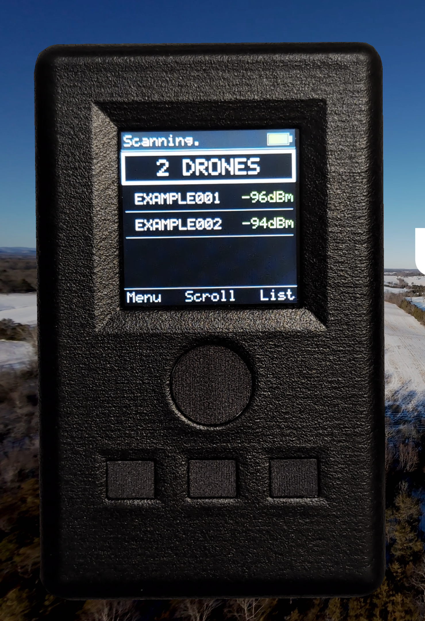
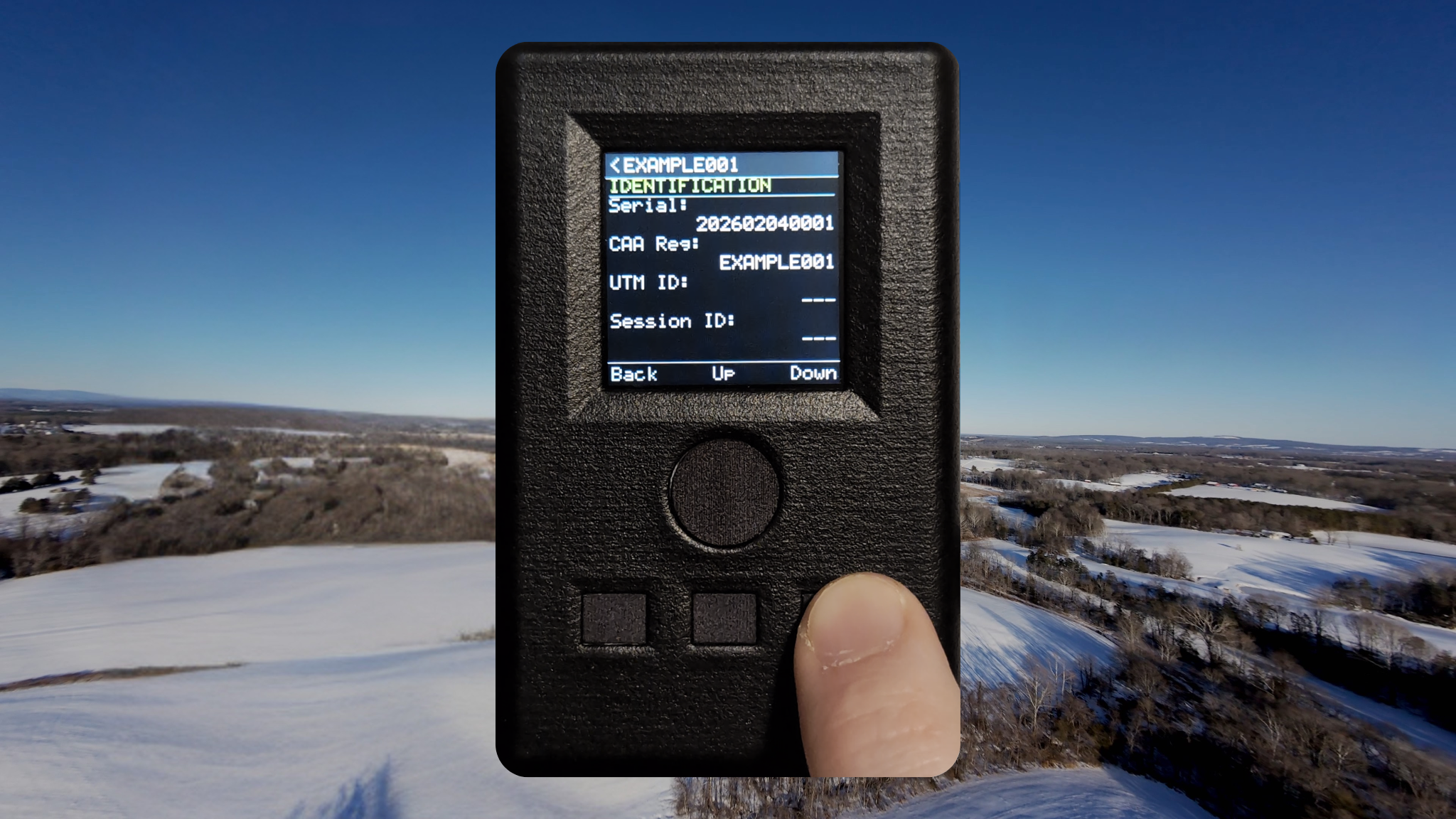
Built for the Field
View active drones at a glance, select for full decoded details. All detections logged automatically and retained until cleared. Export full data logs via USB-C.
View It On a Map
Scan the on-device QR code to view drone flight paths on an interactive map in your browser. Individual coordinates can also be opened in Apple or Google Maps.
Try the map viewer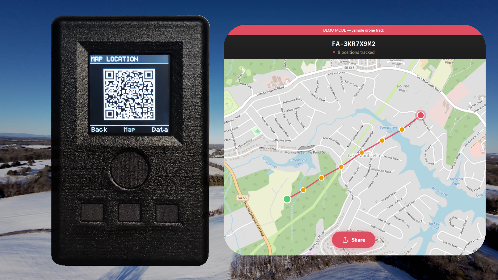
Awareness, Not Confrontation
Operator location is intentionally not displayed. Locus is designed as an awareness tool, not enforcement equipment.
Know What's In Your Airspace
Back the project on Kickstarter, or sign up for launch updates.